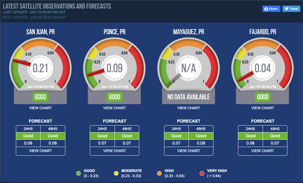
Latest Satellite Observations and Forecasts
LAST UPDATE: Feb 03 06:00 PM AST NEXT UPDATE: Feb 04 06:00 AM ASTSan Juan, PR
 N/A
N/A

Forecast
| 24HS | 48HS |
|---|---|
| Good | Good |
| 0.2 | 0.15 |
|
VIEW CHART
|
|
Ponce, PR
 N/A
N/A

Forecast
| 24HS | 48HS |
|---|---|
| Good | Good |
| 0.14 | 0.11 |
|
VIEW CHART
|
|
Mayaguez, PR
 N/A
N/A

Forecast
| 24HS | 48HS |
|---|---|
| Good | Good |
| 0.16 | 0.1 |
|
VIEW CHART
|
|
Fajardo, PR
 N/A
N/A

Forecast
| 24HS | 48HS |
|---|---|
| Good | Good |
| 0.2 | 0.15 |
|
VIEW CHART
|
|
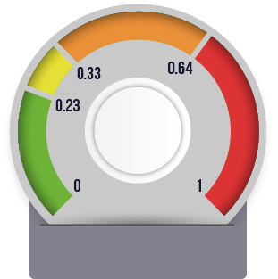
- GOOD (0 - 0.23)
- MODERATE (0.23 - 0.33)
- HIGH (0.33 - 0.64)
- VERY HIGH ( > 0.64)
Disclaimer
This material is based upon work supported by the National Aeronautics and Space Administration (NASA) under Grant No. 80NSSC19K0194 issued through Applied Sciences Program of the NASA Earth Science Division. This project is funded and supported by the National Aeronautics and Space Administration (NASA), under Grant No. 80NSSC19K0194 issued through Applied Sciences Program of the NASA Earth Science Division. Any opinions, findings, and conclusions or recommendations expressed in this material are those of the author(s) and do not necessarily reflect the views of the National Aeronautics and Space Administration.
This information is presented as a good faith service to the scientific community, the public in general and to our colleagues and friends. The information, views and opinions herein provided should not be viewed as formally accurate scientific data and/or advice that can be relied upon without proper verification and validation. This service should not be construed as a substitute for specific data that could be obtained though official sources. If any inaccuracy is observed, please inform CaRA as soon as possible for verification and correction, as necessary. Use of and reliance upon the information provided in this web site signifies that its user(s) understands and has(ve) accepted of the above mentioned caveat and conditions.


